Conservation Technology
Building on the strategic plans at UC San Diego and the Scripps Institution of Oceanography, the Sandin Lab takes an interdisciplinary approach to find innovative solutions to research questions and conservation issues. Working with partners in the computer science and engineering departments, we have developed a data collection and analytical pipeline that leverages advances in modern digital imaging and computing. The results of this partnership has been an unprecedented opportunity to collect and extract ecological information at previously unavailable rates. To accommodate these dramatic increases of data, we are also working with our partners to implement computer assisted classification approaches. Importantly, we are committed to fostering information exchange and data sharing.
CENTER FOR ENVIRONMENTAL IMAGING
Interested in how our techniques and technology could influence your project or study? The Center for Environmental Imaging is a comprehensive software consulting services firm, providing 3D image-based modeling of large-scale environments. CEI can provide all or part of the data collection and analysis needed to make informed decisions and observations over time.
CEI provides clients with environmental image and data acquisition in the field, model construction, technical analysis, and repeat monitoring as needed.
The goal of CEI is to empower clients with research solutions developed to create an imaging and visualization pipeline that fundamentally restructures the way that we can interact with a variety of data and environments.
INNOVATE | EXPLORE | SHARE
in collaboration with Schmidt Marine Technology PARTNERS
Schmidt Marine Technology Partners works to advance the frontiers of global marine research by providing state of the art operational, technological, and informational support to the pioneering ocean science and technology development projects at sea.
Together, the Sandin Lab and Schmidt Marine Technology Partners project aims to describe and understand the variation and structure of coral reefs across the globe. We aim to do so through collaboration with national and community groups living next-door to the world's coral reefs. We team with island organizations, providing technical support for groups to complete large-area imaging, and we provide computational support. The island organizations use imagery to track change on these managed coral reef ecosystems using virtual reality and other conservation technologies.
LARGE AREA IMAGERY COLLECTION + PROCESSING
STANDARD OPERATING PROCEDURES
Our team has been working to build a pipeline for employing large-area imaging to improve the quality and volume of coral reef demographic data. This effort has involved R&D efforts of ecologists, engineers, and field practitioners.
In an effort to share what we have learned, our team has synthesized insights into a living document summarizing the standard operating procedures. We worked with colleagues from the Coral Restoration Consortium to offer an introductory webinar on this pipeline. The strength of large-area imagery in coral reefs will be maximized when we can share our insights of reef habitats from across the planet and through the years!
The webinar covers the motivation and rationale of photomosaics, the steps involved with collecting the data and creating the product, and examples of how the technology has been used by restoration practitioners. Guest speakers include Art Gleason, Stuart Sandin, Nicole Pedersen, Alex Neufeld and Lisa Carne.


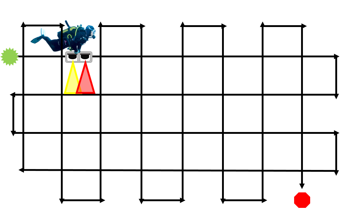
Image collection fly-over pattern.
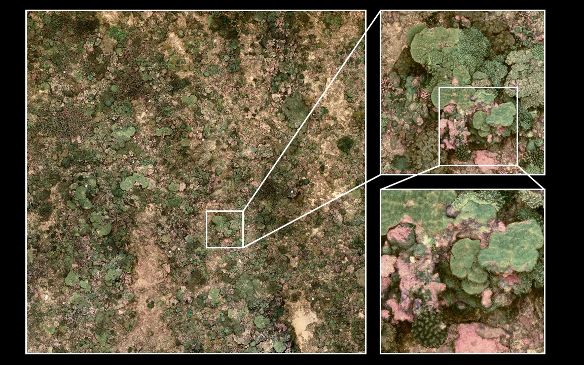
Millions of data points allows great detail at scale.
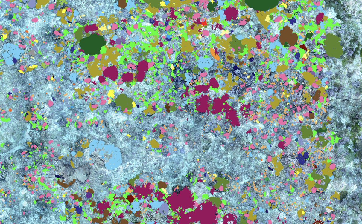
Identification of coral species from processed data.
